File:The Fifth of Trees.jpg
Revision as of 05:18, 24 February 2019 by Patrick (talk | contribs) (Patrick uploaded a new version of File:The Fifth of Trees.jpg)
Size of this preview: 741 × 599 pixels. Other resolutions: 297 × 240 pixels | 3,302 × 2,671 pixels.
Original file (3,302 × 2,671 pixels, file size: 1.14 MB, MIME type: image/jpeg)
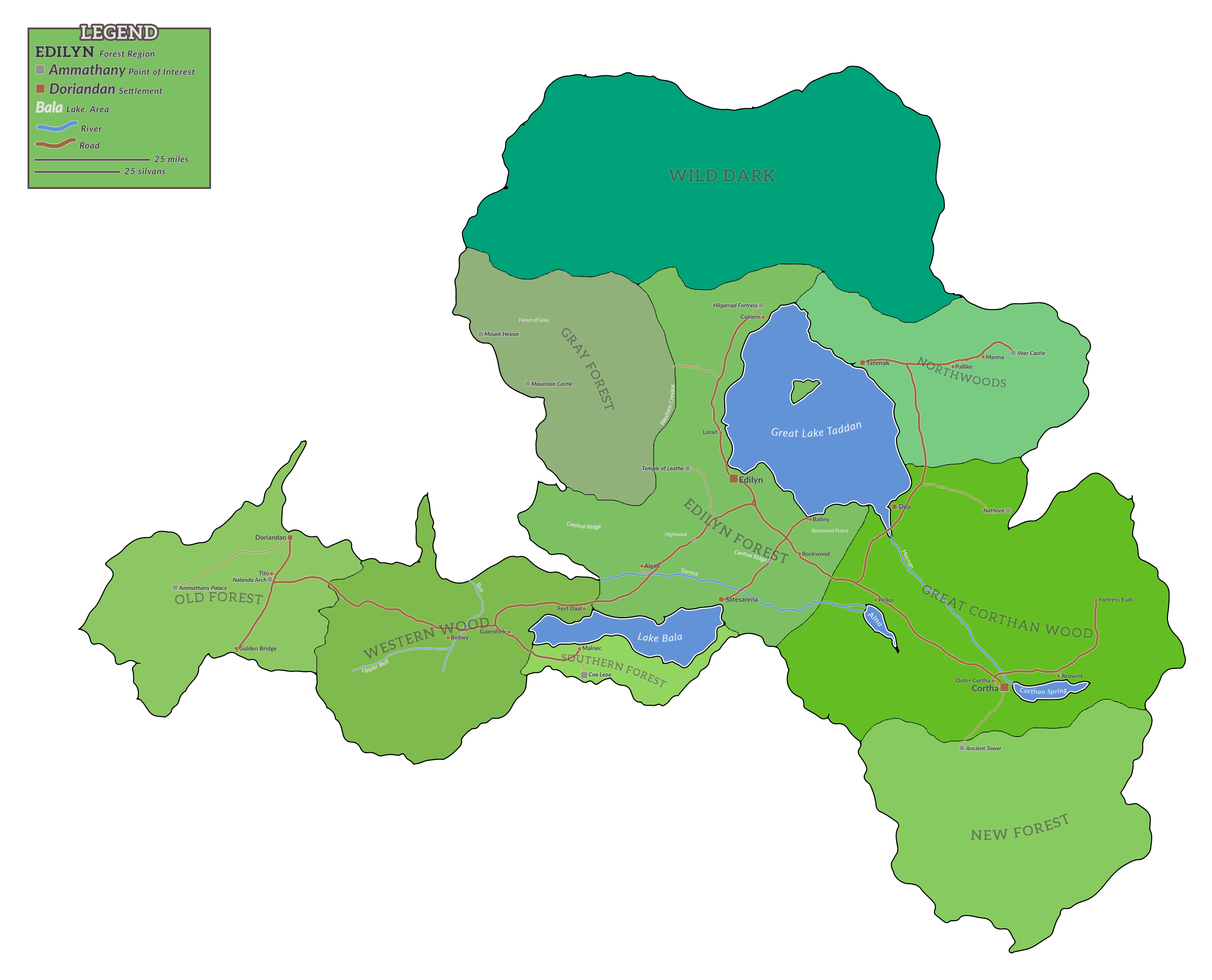
This is a Regional map of the Fifth of Trees; being divided into colored blocks representing the nine constituent Forest Regions of the Fifth. It shows the principal settlements and several points of interest. The four major lakes and two rivers are shown and labeled. Visibly traversable thoroughfares are shown.
File history
Click on a date/time to view the file as it appeared at that time.
| Date/Time | Thumbnail | Dimensions | User | Comment | |
|---|---|---|---|---|---|
| current | 17:30, 5 March 2019 | | 3,302 × 2,671 (1.14 MB) | Patrick (talk | contribs) | Art, labels |
| 05:18, 24 February 2019 | 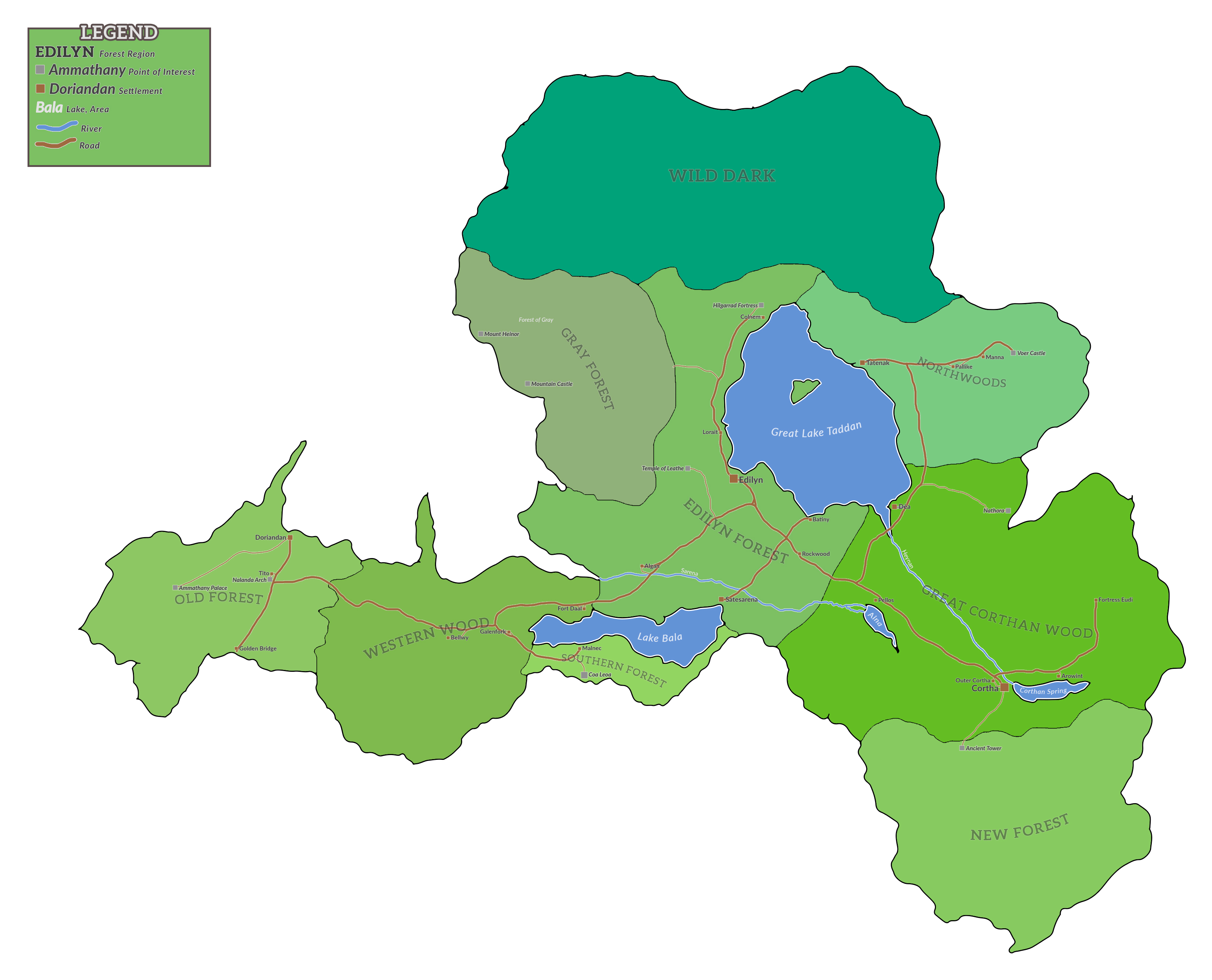 | 3,302 × 2,671 (1.11 MB) | Patrick (talk | contribs) | Legend, some names | |
| 16:57, 12 February 2019 | 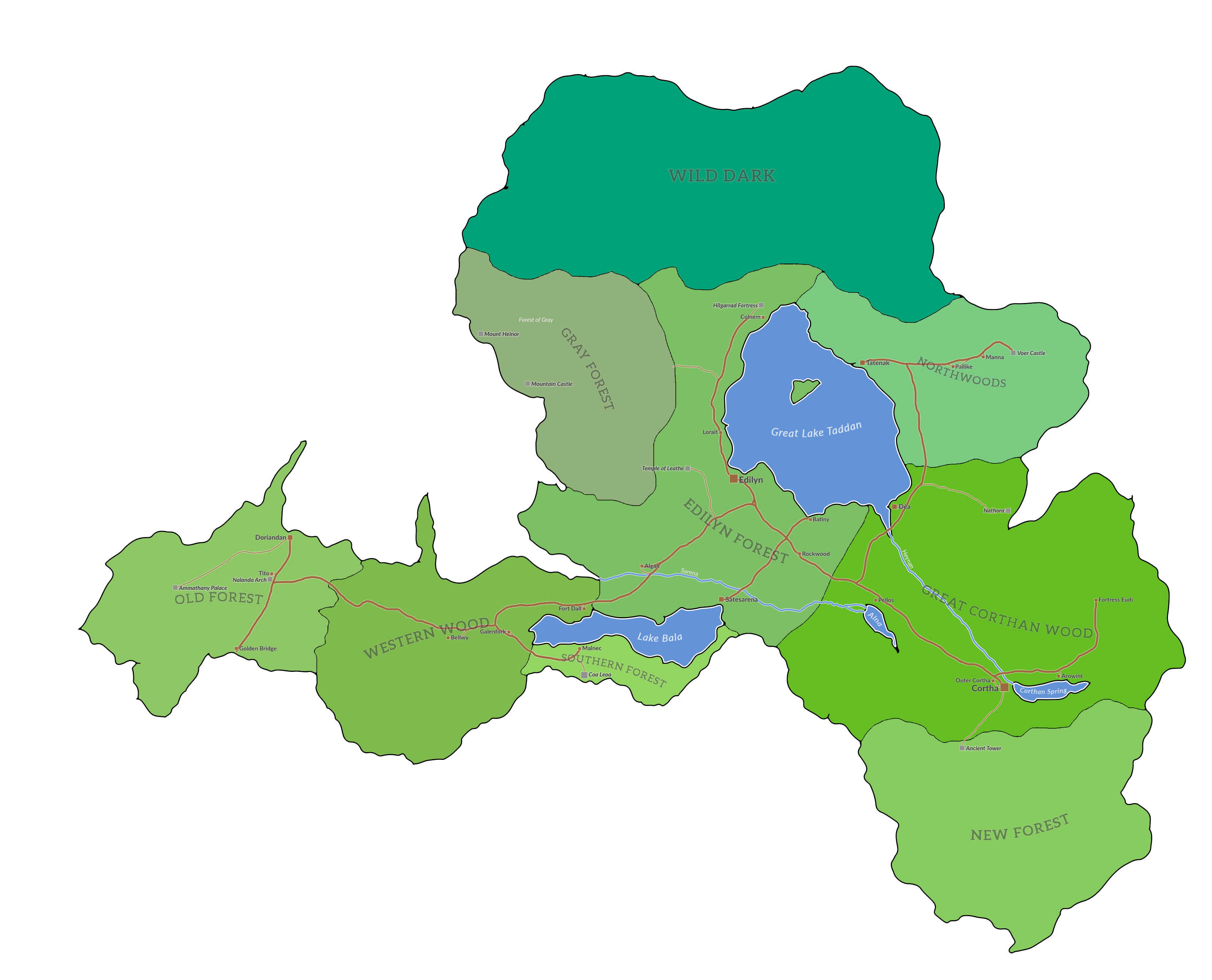 | 3,302 × 2,671 (1.01 MB) | Patrick (talk | contribs) |
- You cannot overwrite this file.
File usage
The following page uses this file: